

Visit VBWT Sites on Prince William County’s African American History Trail
By Lisa Mease/DWR
Photos by Lisa Mease/DWR
Prince William County has put together a guided tour of sites important to the county’s history and that of its African American residents. Three of those spots are also sites on the Virginia Bird and Wildlife Trail.
Manassass National Battlefield Park
The dedication of the National Park Service to maintaining Manassass National Battlefield Park’s grounds in their original state has also created a unique wildlife viewing opportunity. The native grasslands that are carefully sustained for historical accuracy are amongst the most extensive remaining in the county. Grassland species such as grasshopper sparrow, eastern bluebird, field sparrow, northern bobwhite, and red-tailed hawk may be common at certain times of the year. The Park’s bird list currently includes 187 species. While spotting wildlife, you can also ponder the important historical moments that took place on this ground.
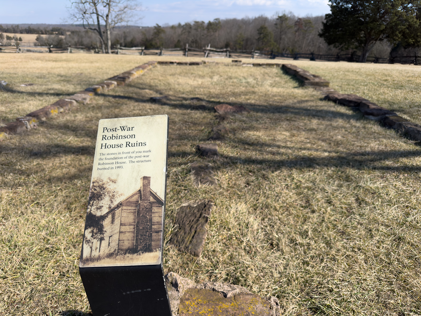
In 1840, James Robinson, a free African American, purchased 170 acres of land in Prince William County. He began construction of a 400 square foot, 1 ½ story home in 1878 for himself and his family. As a successful businessman and farmer, he was one of the wealthiest free African Americans in Prince William County. However, like many landowners in the area, Robinson’s property was commandeered during the American Civil War. In 1861, Confederates took up position along his farm lane during the First Battle of Manassas. The Union Army used Robinson’s house as its headquarters during the Second Battle of Manassas in 1862, and it served as a field hospital following the battle. After the war ended, Robinson went on to build a 2 ½ story addition, and several other improvements were made after his death in 1875. His descendants lived there until the 1930s. Sadly, the house burned to the ground in 1993, but its foundation is visible today in the Manassas National Battlefield Park.

Named after the revered naturalist and author Aldo Leopold, Leopold’s Preserve is a nature preserve and urban oasis containing diverse habitats and a rich history. Its seven miles of natural surface trails traverse wetlands, wildflower meadows, and hardwood forests, providing opportunities to spot a wide variety of birds and other wildlife, including turtles, frogs, deer, muskrat, beaver, butterflies, and dragonflies.
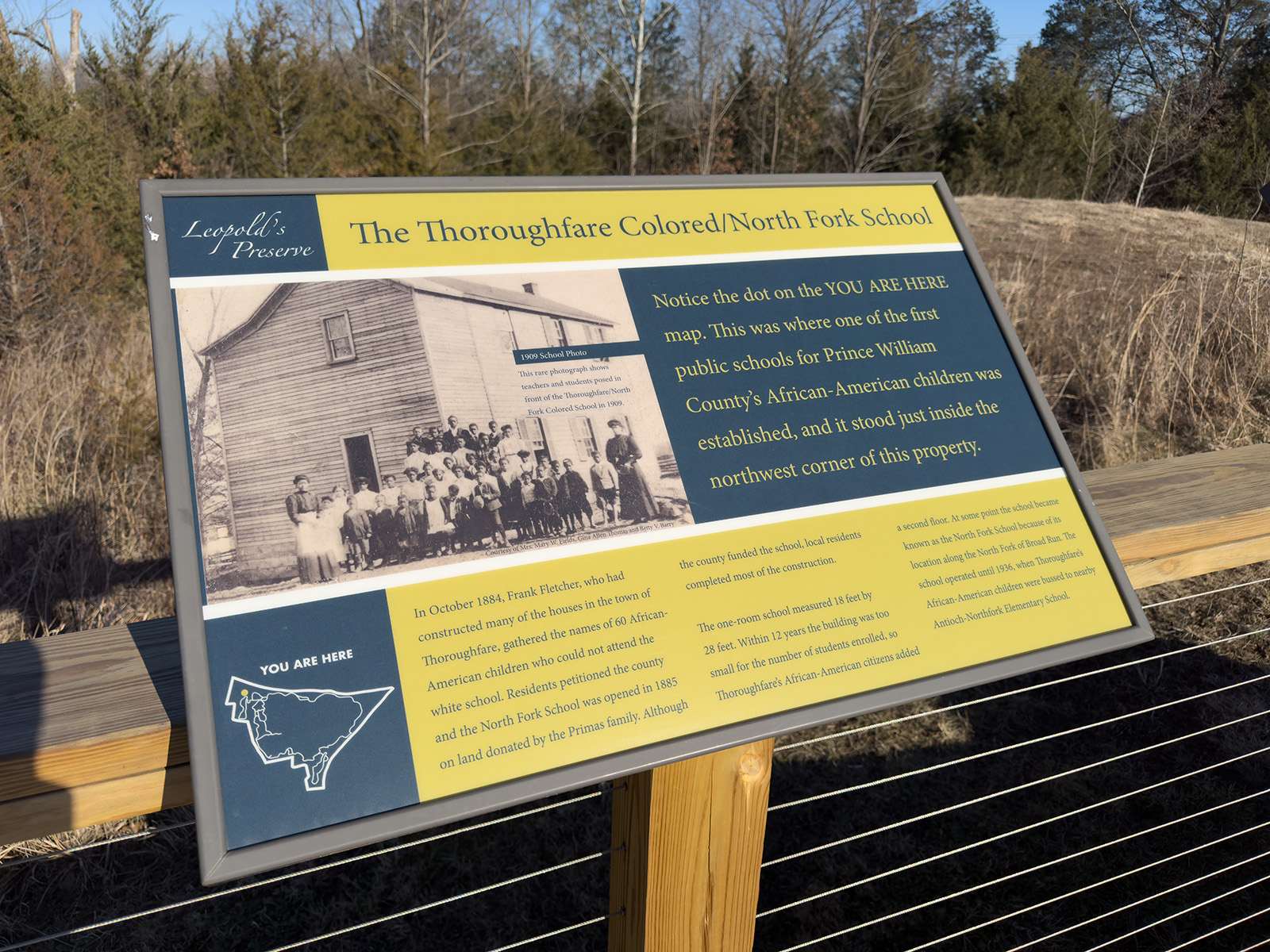
The 380 acres of Leopold’s Preserve was once part of a larger Black community established after the American Civil War known as Thoroughfare. Named after the nearby gap, this area has been used by humans for thousands of years; but by 1700, white Europeans had forced the indigenous peoples off the land and owned much of it during the antebellum years. As the Civil War raged in Virginia, many formerly enslaved men who would go on to establish Thoroughfare took up arms for the Union. In the years following the war, they and other families were able to purchase land and create a farming community that thrived here until the 1940s. Leopold’s Preserve encompasses several significant Thoroughfare sites, such as Berry Pond, a popular swimming and fishing hole for local residents. Interpretive signs highlighting the history of the area are found throughout the preserve, including near the sites of the former North Fork and Antioch-McCrae Schools.
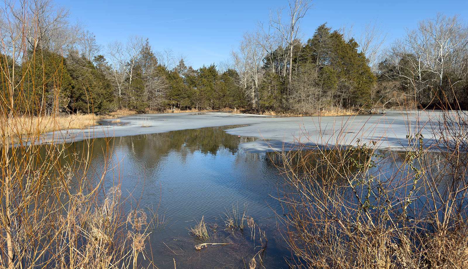
Berry Pond in Leopold’s Preserve
The waterfront setting of this park on a peninsula attracts great numbers and varieties of water birds such as large waders, terns, gulls, cormorants, and both diving and puddle ducks. Ospreys and bald eagles are commonly viewed here as well. Wetlands along two tidal creeks increase the diversity of water-dependent species. In addition to the wetland and water habitats, the park has six miles of trails through old deciduous forests where species of warblers, vireos, woodpeckers, owls, hawks, and other woodland birds can be viewed.
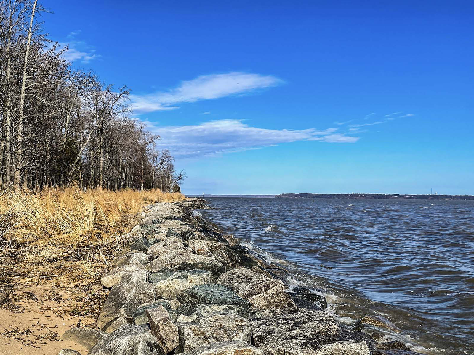
Opened in 1989 on 508 acres of land formerly owned by Robert E. Lee’s grandfather, Henry Lee II, Leesylvania State Park is included in the National Park Service’s Network to Freedom because of its connection to the Underground Railroad. Enslaved people began passing through this area in the 1780s on their way to freedom in the North; the true number is unknown but contemporaneous newspapers list 12 names. During the American Civil War, the Confederate Army encamped at the easternmost tip of the park, called Freestone Point, after winning the First Battle of Manassas in 1861. Once there, they began work on a battery that consisted of four gun emplacements. According to author Mary Alice Willis, five escaping enslaved people swam out to the U.S. Steam Sloop Seminole on September 23, 1861, and reported that 200 Confederates had passed through their master’s land and were making their way to Freestone Point with siege guns. The emplacement and interpretive signage can be found today along the Lee’s Woods Trail.
Distribution channels:
Legal Disclaimer:
EIN Presswire provides this news content "as is" without warranty of any kind. We do not accept any responsibility or liability for the accuracy, content, images, videos, licenses, completeness, legality, or reliability of the information contained in this article. If you have any complaints or copyright issues related to this article, kindly contact the author above.
Submit your press release